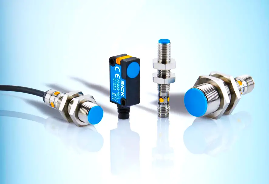
Functionalities of Sensors Navigation and Localization
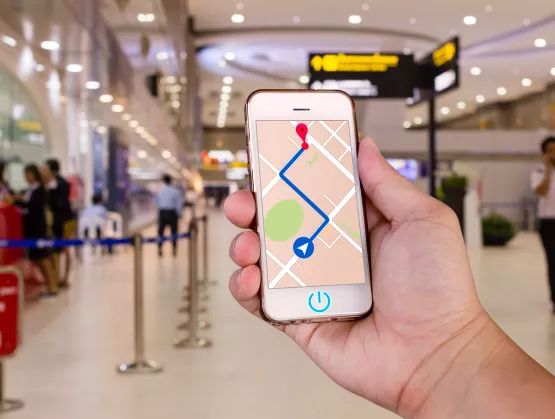
- Navigation and Localization:
Sensors play a crucial role in robot navigation and localization, enabling robots to determine their position and orientation relative to their surroundings. Inertial sensors provide motion data for dead reckoning, while vision sensors and LiDAR generate maps for localization and path planning. By fusing data from multiple sensors, robots can navigate autonomously in complex environments with accuracy and efficiency.
Functionalities of Sensors in Navigation and Localization in Robotics: Navigating the World with Precision
Navigation and localization are fundamental capabilities for robots to operate autonomously and effectively in various environments, ranging from indoor spaces to outdoor terrains. Sensors play a crucial role in enabling robots to perceive their surroundings, determine their position, and navigate safely to their destination. By harnessing a combination of sensor modalities and advanced algorithms, robots can achieve accurate navigation and localization, allowing them to fulfill a wide range of tasks in diverse applications. Let’s delve into the functionalities of sensors in navigation and localization in robotics, exploring their principles, applications, and transformative impact.
Principles of Navigation and Localization:
Navigation and localization in robotics involve determining a robot’s position and orientation relative to its surroundings and planning a trajectory to navigate from one point to another. These principles guide the process of navigation and localization:
- Position Estimation:
Position estimation involves determining the robot’s position in a coordinate system, typically represented by Cartesian coordinates (x, y, z) or geographical coordinates (latitude, longitude, altitude). Sensors such as GPS, IMUs, and wheel encoders provide measurements of position and velocity, which are used to estimate the robot’s current location and velocity.
Position Estimation in Robotics: Navigating the Path to Precision
Position estimation is a fundamental aspect of robotics, enabling robots to determine their location and orientation relative to their surroundings. This capability is essential for tasks such as navigation, localization, mapping, and interaction with the environment. By harnessing a variety of sensors, algorithms, and techniques, robots can achieve accurate and reliable position estimation in diverse environments and operating conditions. In this comprehensive exploration, we’ll delve into the principles, methodologies, and applications of position estimation in robotics, uncovering its critical role in shaping the future of autonomous systems.
Principles of Position Estimation:
Position estimation involves determining a robot’s position and orientation in a given coordinate system, typically represented in Cartesian (x, y, z) or geographical (latitude, longitude, altitude) coordinates. Several principles underpin the process of position estimation:
- Sensor Integration:
Position estimation often relies on integrating data from multiple sensors to obtain a comprehensive understanding of the robot’s surroundings. These sensors may include GPS, inertial measurement units (IMUs), wheel encoders, cameras, LiDAR, radar, and sonar, each providing unique information about the robot’s motion and environment.
- Sensor Fusion:
Sensor fusion techniques combine data from multiple sensors to improve the accuracy, reliability, and robustness of position estimation. Fusion algorithms leverage the complementary strengths of different sensors while compensating for individual sensor limitations, such as noise, drift, or environmental disturbances.
- Dead Reckoning:
Dead reckoning is a technique used to estimate a robot’s position based on its previous known position and motion information. This method relies on integrating measurements of velocity and orientation over time, often obtained from wheel encoders, IMUs, or odometry sensors, to predict the robot’s trajectory and update its position estimate.
- Localization:
Localization techniques determine a robot’s position relative to a known reference frame or map of the environment. Localization algorithms leverage sensor data, such as GPS, LiDAR, or visual landmarks, to match observed features with map features and estimate the robot’s position and orientation within the map.
Simultaneous Localization and Mapping (SLAM):
SLAM is a technique used to simultaneously build a map of the environment and localize the robot within the map without prior knowledge of the environment’s structure. SLAM algorithms integrate sensor data, such as LiDAR or camera images, to incrementally update the map and estimate the robot’s position and orientation in real-time.
Methodologies for Position Estimation:
Position estimation in robotics employs various methodologies and algorithms to achieve accurate and reliable results:
- Kalman Filtering:
Kalman filtering is a recursive algorithm used for state estimation in dynamic systems, including position estimation in robotics. Kalman filters combine predictions from a motion model with measurements from sensors to estimate the robot’s state, accounting for uncertainty in both the motion model and sensor measurements.
- Particle Filtering:
Particle filtering, also known as Monte Carlo localization, is a probabilistic technique used for localization and tracking in non-linear and non-Gaussian environments. Particle filters maintain a set of representative samples (particles) that approximate the robot’s state distribution and update these samples based on sensor measurements to estimate the robot’s position.
- Optical Flow:
Optical flow is a computer vision technique used to estimate the relative motion of objects in a visual scene based on changes in pixel intensity over time. Optical flow algorithms analyze sequential images from a camera to detect motion patterns and estimate the robot’s velocity and displacement, which can be integrated over time to estimate its position.
- Visual Odometry:
Visual odometry is a technique used to estimate a robot’s motion by analyzing sequential images captured by a camera. Visual odometry algorithms track visual features or keypoints between consecutive images and use their motion to estimate the robot’s trajectory and update its position estimate.
- Feature-based Localization:
Feature-based localization techniques identify distinctive features or landmarks in the environment, such as corners, edges, or visual patterns, and match these features between sensor measurements and a reference map. Feature-based localization algorithms estimate the robot’s position by triangulating observed features with known map features.
Applications of Position Estimation in Robotics:
Position estimation has numerous applications across various domains and industries:
- Autonomous Vehicles:
Position estimation enables autonomous vehicles, including self-driving cars, drones, and unmanned aerial vehicles (UAVs), to navigate safely and accurately in dynamic environments. Autonomous vehicles rely on precise position estimation to plan trajectories, avoid obstacles, and adhere to traffic regulations.
- Robotics Research:
Position estimation is essential for robotics research and development, enabling researchers to study navigation algorithms, localization techniques, and autonomous systems. Robotics researchers use position estimation to evaluate the performance of algorithms in simulated and real-world environments and validate new methodologies and techniques.
- Search and Rescue:
Position estimation plays a vital role in search and rescue missions, enabling robots to navigate hazardous or inaccessible environments and locate survivors or victims. Search and rescue robots rely on accurate position estimation to plan search patterns, avoid obstacles, and transmit location information to rescue teams.
- Precision Agriculture:
Position estimation is used in precision agriculture for monitoring crop health, optimizing irrigation, and managing agricultural machinery. Agricultural robots equipped with GPS and sensors use position estimation to navigate fields, apply fertilizers or pesticides with precision, and collect data for yield monitoring and analysis.
- Industrial Automation:
Position estimation is employed in industrial automation applications such as warehouse logistics, material handling, and manufacturing. Autonomous robots equipped with localization sensors navigate warehouses, transport goods, and perform tasks such as inventory management and order fulfillment with high accuracy and efficiency.
Advancements and Future Directions:
Advancements in position estimation techniques are driving innovation and expanding the capabilities of robotic systems. Key
trends and future directions include:
- Integration of Sensor Modalities:
Fusion of multiple sensor modalities, including GPS, IMUs, LiDAR, and cameras, enables robots to achieve robust and reliable position estimation in diverse environments and operating conditions.
- Machine Learning and Deep Learning:
Machine learning and deep learning techniques are increasingly being applied to position estimation tasks, enabling robots to learn from data and improve performance in complex and dynamic environments.
- Edge Computing and Real-time Processing:
Edge computing and real-time processing enable robots to perform position estimation tasks onboard or in distributed computing environments, reducing latency and improving responsiveness in time-critical applications.
- Adaptive and Resilient Algorithms:
Adaptive and resilient position estimation algorithms are designed to adapt to changing environmental conditions, sensor failures, or unforeseen disturbances, ensuring reliable performance in challenging scenarios.
- Human-Robot Collaboration:
Position estimation techniques enable robots to collaborate with humans in shared workspaces, such as warehouses, factories, and healthcare facilities, ensuring safe and efficient interaction between robots and humans.
- Environment Perception:
Environment perception involves gathering information about the surrounding environment, including obstacles, landmarks, and terrain features. Sensors such as cameras, LiDAR, radar, and ultrasonic sensors provide sensory data used to create a map of the environment, detect obstacles, and identify navigational landmarks.
- Map Representation:
Map representation involves creating a spatial representation of the environment, known as a map, which contains information about the layout, obstacles, and features of the environment. Maps can be created using techniques such as SLAM (Simultaneous Localization and Mapping), which integrates sensor data to simultaneously localize the robot and map its surroundings.
- Trajectory Planning:
Trajectory planning involves generating a path or trajectory for the robot to follow from its current position to a target destination while avoiding obstacles and adhering to constraints such as motion limits and safety requirements. Path planning algorithms use information from the environment map to generate collision-free trajectories that minimize travel time and energy consumption.
- Control and Actuation:
Control and actuation involve executing the planned trajectory by sending commands to the robot’s actuators, such as motors, wheels, or thrusters. Control algorithms adjust the robot’s motion based on feedback from sensors, ensuring that it follows the planned trajectory accurately and responds to changes in the environment.
Functionalities of Sensors in Navigation and Localization:
Sensors provide robots with critical functionalities that enable accurate navigation and localization in various environments:
- Global Positioning System (GPS):
GPS sensors provide accurate position and velocity information by receiving signals from satellites orbiting the Earth. GPS enables robots to determine their absolute position on the Earth’s surface, making it particularly useful for outdoor navigation in large-scale environments such as urban areas, highways, and rural landscapes.
Inertial Measurement Units (IMUs):
IMUs consist of sensors such as accelerometers and gyroscopes that measure the robot’s acceleration and angular velocity. IMUs provide continuous estimates of the robot’s orientation and motion, enabling precise localization and motion control in dynamic environments where GPS signals may be unavailable or unreliable.
- Wheel Encoders:
Wheel encoders measure the rotation of the robot’s wheels or actuators, providing information about the robot’s linear and angular displacement. Wheel encoders are commonly used in wheeled robots for odometry, enabling accurate localization and motion estimation by tracking the robot’s wheel movements relative to the ground.
- LiDAR (Light Detection and Ranging):
LiDAR sensors emit laser beams to measure distances to objects in the environment, generating high-resolution 3D maps of the surroundings. LiDAR enables robots to detect obstacles, localize themselves accurately, and navigate in complex environments with obstacles, uneven terrain, and dynamic obstacles such as moving vehicles or pedestrians.
- Cameras:
Cameras capture visual images of the environment, allowing robots to perceive landmarks, detect objects, and navigate based on visual cues. Vision-based navigation techniques use image processing and computer vision algorithms to extract features from camera images, such as keypoints, edges, or textures, which are used for localization, mapping, and obstacle avoidance.
- Ultrasonic Sensors:
Ultrasonic sensors emit high-frequency sound waves and measure the time it takes for the sound waves to reflect off nearby objects and return to the sensor. Ultrasonic sensors provide range information used for obstacle detection, collision avoidance, and localization in indoor environments where GPS signals may be unavailable or unreliable.
- Radar:
Radar sensors emit radio waves to detect objects in the environment and measure their distance, velocity, and angle of arrival. Radar enables robots to navigate in adverse weather conditions such as fog, rain, or snow, where visual sensors may be impaired, by providing reliable long-range detection and localization capabilities.
Radar in Robotics: Unveiling the Spectrum of Sensing
Radar, short for Radio Detection and Ranging, is a pivotal sensing technology that has revolutionized various fields, including aviation, meteorology, defense, and robotics. In the realm of robotics, radar systems play a crucial role in enabling robots to perceive their surroundings, detect obstacles, and navigate autonomously in diverse environments. This comprehensive exploration delves into the principles, functionalities, and applications of radar in robotics, unraveling its significance as a key component of robotic systems.
- Principles of Radar:
Radar operates based on the principle of emitting electromagnetic waves, typically in the radio frequency (RF) or microwave range, and analyzing the reflections or echoes of these waves off objects in the environment. The basic components of a radar system include:
- Transmitter:
The transmitter generates electromagnetic waves, often in the form of short pulses, and emits them into the surrounding space. The transmitter determines the frequency, power, and modulation characteristics of the emitted waves, which influence the radar’s range, resolution, and sensitivity.
- Antenna:
The antenna radiates the electromagnetic waves generated by the transmitter and collects the reflections or echoes of these waves from objects in the environment. The antenna’s design, including its size, shape, and radiation pattern, determines the radar’s coverage area, beamwidth, and directionality.
- Receiver:
The receiver amplifies and processes the received signals, extracting information about the distance, velocity, and properties of objects in the radar’s field of view. The receiver’s sensitivity, bandwidth, and signal processing capabilities influence the radar’s ability to detect and discriminate targets in the presence of noise or interference.
- Signal Processing:
Signal processing algorithms analyze the received signals to extract relevant information, such as the range, bearing, and Doppler shift of detected objects. These algorithms filter, demodulate, and analyze the radar echoes to detect and track targets, estimate their motion, and generate situational awareness for the robot.
Functionalities of Radar in Robotics:
Radar systems provide robots with critical functionalities that enable them to perceive, navigate, and interact with the environment effectively:
- Obstacle Detection:
Radar sensors detect obstacles, including vehicles, pedestrians, buildings, and other objects, in the robot’s vicinity. By analyzing the reflections of radar waves off objects, robots can perceive their surroundings and identify potential hazards or obstacles in their path.
- Collision Avoidance:
Radar sensors enable robots to navigate safely and avoid collisions with obstacles or other vehicles in dynamic environments. Collision avoidance algorithms use information from radar sensors to plan trajectories, adjust speed, and steer the robot away from obstacles to ensure safe navigation.
- Localization and Mapping:
Radar sensors contribute to localization and mapping tasks by providing information about the robot’s position relative to landmarks or reference points in the environment. By measuring the distance and angle to objects in the environment, radar sensors help robots localize themselves accurately and build maps of their surroundings.
- Environment Monitoring:
Radar sensors facilitate environmental monitoring and surveillance by detecting and tracking moving objects, such as vehicles, aircraft, or wildlife, in the robot’s vicinity. Radar-based surveillance systems provide situational awareness for robots and enable them to detect and respond to dynamic changes in the environment.
- Weather Sensing:
Radar sensors are capable of detecting and characterizing weather phenomena, such as rain, fog, snow, and hail, in the robot’s vicinity. Weather sensing capabilities enable robots to adapt their behavior and navigation strategies based on current weather conditions, ensuring safe and efficient operation in adverse weather environments.
Applications of Radar in Robotics:
Radar technology finds numerous applications across various domains and industries:
- Autonomous Vehicles:
Radar sensors play a critical role in autonomous vehicles, including self-driving cars, drones, and unmanned aerial vehicles (UAVs). Radar-based perception systems provide essential information for obstacle detection, collision avoidance, and path planning, enabling autonomous vehicles to navigate safely and efficiently in complex traffic environments.
- Mobile Robotics:
Radar sensors are used in mobile robots for navigation, localization, and obstacle avoidance in indoor and outdoor environments. Mobile robots equipped with radar sensors can navigate autonomously, map their surroundings, and perform tasks such as surveillance, inspection, and monitoring in dynamic and unstructured environments.
- Robotics Research:
Radar technology is widely used in robotics research and development for studying sensing algorithms, navigation techniques, and autonomous systems. Robotics researchers leverage radar sensors to evaluate the performance of algorithms in simulated and real-world scenarios, validate new methodologies, and develop innovative applications for robotic systems.
- Industrial Automation:
Radar sensors are employed in industrial automation applications, such as warehouse logistics, material handling, and perimeter surveillance. Radar-based detection systems enable autonomous robots to navigate warehouses, transport goods, and monitor facilities, improving efficiency and safety in industrial environments.
- Defense and Security:
Radar technology plays a vital role in defense and security applications, including perimeter surveillance, border control, and threat detection. Radar-based surveillance systems provide early warning of potential threats, track moving objects in real-time, and support decision-making for security personnel and autonomous defense systems.
Advancements and Future Directions:
Advancements in radar technology are driving innovation and expanding the capabilities of robotic systems. Key trends and future directions include:
- Miniaturization and Integration:
Miniaturization of radar sensors and integration into compact and lightweight packages enable the deployment of radar-based perception systems in small-scale robots, drones, and wearable devices.
- Multi-Modal Fusion:
Fusion of radar data with information from other sensor modalities, such as cameras, LiDAR, and IMUs, enhances the robustness and reliability of robotic perception systems, enabling robots to perceive their surroundings more accurately and comprehensively.
- Advanced Signal Processing:
Development of advanced signal processing algorithms, including machine learning and deep learning techniques, enables robots to extract more meaningful information from radar data, improve object detection and tracking capabilities, and adapt to dynamic and challenging environments.
- Weather Resilience:
Integration of advanced weather sensing capabilities into radar systems enables robots to operate effectively in adverse weather conditions, such as rain, fog, snow, and dust storms, by providing accurate and reliable weather information for navigation and decision-making.
- Situational Awareness:
Enhancement of radar-based surveillance systems with artificial intelligence and data analytics enables robots to gain deeper situational awareness, detect anomalous behavior, and identify potential threats or security risks in real-time.
Applications of Navigation and Localization Sensors:
Navigation and localization sensors are used in a wide range of robotic applications across industries and domains:
Autonomous Vehicles:
Navigation sensors such as GPS, LiDAR,
cameras, and IMUs enable autonomous vehicles to navigate safely and accurately in urban, rural, and highway environments. These sensors provide essential information for localization, obstacle detection, traffic monitoring, and path planning, ensuring safe and efficient autonomous driving.
- Mobile Robots:
Mobile robots, including drones, ground robots, and underwater robots, use navigation sensors for autonomous exploration, mapping, and surveillance. LiDAR, cameras, and IMUs enable mobile robots to navigate in indoor and outdoor environments, perform tasks such as search and rescue, inspection, and monitoring, and adapt to dynamic and unstructured surroundings.
- Industrial Automation:
Navigation sensors play a critical role in industrial automation applications such as warehouse logistics, manufacturing, and material handling. LiDAR, wheel encoders, and cameras enable autonomous robots to navigate warehouse environments, transport goods, and optimize inventory management, increasing efficiency and reducing labor costs.
- Agricultural Robotics:
Navigation sensors are used in agricultural robotics for precision farming, crop monitoring, and autonomous agricultural machinery. GPS, LiDAR, and cameras enable agricultural robots to navigate fields, monitor crop health, and perform tasks such as planting, spraying, and harvesting with high precision and efficiency.
- Robotics Research:
Navigation and localization sensors are essential tools for robotics research and development, enabling researchers to study robot navigation algorithms, SLAM techniques, and autonomous systems. Open-source software frameworks and simulation platforms provide access to navigation sensor data for testing and validation of algorithms in realistic environments.
Advancements and Future Directions:
Advancements in navigation and localization sensors are driving innovation and expanding the capabilities of robotic systems. Key trends and future directions include:
- Integration of Sensor Modalities:
Fusion of multiple sensor modalities, such as LiDAR, cameras, and IMUs, enables robots to achieve robust navigation and localization in diverse environments, leveraging the complementary strengths of each sensor.
- Miniaturization and Integration:
Miniaturization of sensors and integration of sensor systems into compact and lightweight packages enable the deployment of navigation and localization capabilities in small-scale robots, drones, and wearable devices.
- Advanced Algorithms:
Development of advanced navigation algorithms, including deep learning-based approaches, reinforcement learning, and probabilistic modeling techniques, enables robots to learn and adapt to complex environments, improving navigation performance and autonomy.
- Real-time Processing:
Real-time processing of sensor data using edge computing and distributed systems enables robots to make rapid and informed decisions, enhancing responsiveness and agility in dynamic environments.
- Robustness and Reliability:
Advancements in sensor technology and algorithm design focus on improving the robustness and reliability of navigation and localization systems, ensuring accurate and consistent performance across a wide range of operating conditions and environments.
Conclusion:
Navigation and localization sensors are essential components of robotic systems, enabling robots to navigate autonomously and interact effectively with the environment. By harnessing a combination of sensor modalities, advanced algorithms, and real-time processing techniques, robots can achieve precise localization, map their surroundings, and navigate safely to their destination. As robotics technology continues to advance, navigation and localization sensors will play a crucial role in enabling more autonomous, adaptive, and intelligent robotic systems, unlocking new opportunities for innovation and applications across industries and domains.
